SIF is a remote sensing index intended to monitor plant production.
More conventional indices, such as NDVI or EVI, measure greenness of vegetation-- which is less ideal for capturing changes in production that are not associated with changes in greenness, like conifers in winter, or plants with different photosynthetic types.
Curious? Click the button below to learn more!
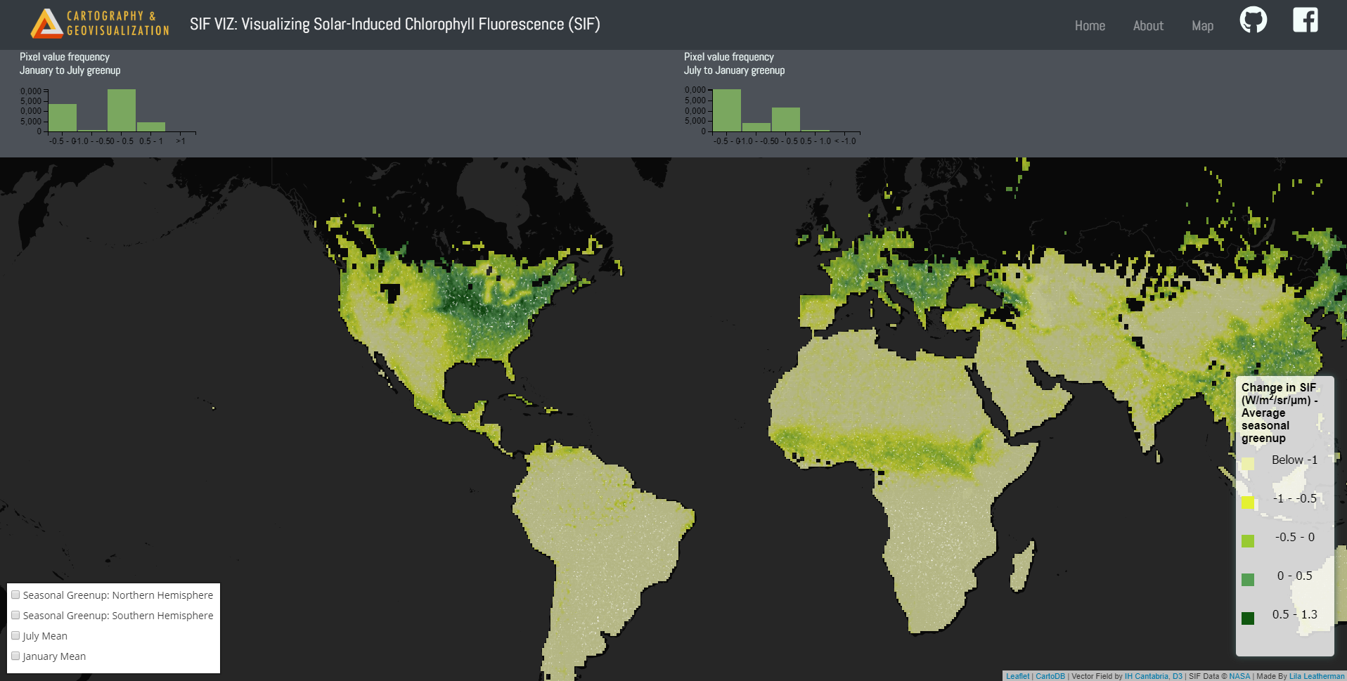
SIFVIZ is a map viewer displaying global seasonal shift in SIF.
Greater intensity of greens indicate greater seasonal change in chlorophyll fluorescence.
White flowing shapes demonstrate direction of increased chlorophyll concentration across seasons.
Click the map image above to view the code driving this visualization.
Ready to view SIFVIZ?
Click the button below to access the SIF Vector Field Animation Map.
.